↓
 

Daphne Land Surveying

...a Brandon Bailey, PLS website.

Daphne Land Surveying - Brandon Bailey header
Daphne Land Surveying
  • Home
  • Land Surveying
  • ALTA Title Survey
  • Boundary Survey
  • Construction Survey
  • Lot Survey
  • Elevation Certificate | Flood Survey
  • Flood Survey
  • Contact Us
Home 1 2 3 … 5 6 >>

Post navigation

← Older posts

Welcome to Daphne Land Surveying

Daphne Land Surveying Posted on March 9, 2017 by AdminDaphneLSMarch 9, 2020

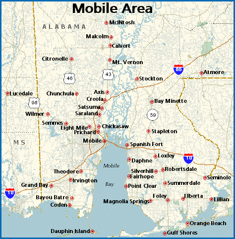
Welcome to Daphne Land Surveying‘s website. This site is intended to provide you with information on Land Surveying in the Daphne, AL, and Baldwin County area of Alabama. If you’re looking for a Daphne Land Surveyor, you’ve come to the right site.

If you’d rather talk to someone about your land surveying needs, please call (251) 270-4140 today or better yet send us a contact form request. For more information, please continue to read

Land Surveyors are professionals who measure and make precise measurements to determine the size and boundaries of a piece of real estate.  While this is a simplistic definition, boundary surveying is one of the most common types of surveying related to home and land owners.

If you fall into the following categories, please click on the appropriate link for more information on that subject:

  1. I need to know where my property corners or property lines are. (Boundary Survey)
  2. I have a loan closing or re-finance coming up on my home in a subdivision. (Lot Survey)
  3. I need a map of my property with contour lines to show elevation differences for my architect or engineer. (Topo Survey)
  4. I’ve just been told I’m in a flood zone or I ‘ve been told I need an elevation certificate in order to obtain flood insurance or prove I don’t need it. (Flood Survey)
  5. I’m purchasing a lot/house in a recorded subdivision. (Lot Survey – See Boundary Survey)
  6. I’m purchasing a large tract of land, acreage, that hasn’t been subdivided in the past. (Boundary Survey)
  7. I need to get some location and grades set on a construction project. (Construction Survey)
  8. I need a survey of a commercial or multi-family site that meets the ALTA Land Title Survey requirements. (ALTA Survey)

If your needs don’t fall into one of the above, don’t worry, we’ll get to the bottom of it.  CALL Daphne Land Surveying TODAY at (251) 270-4140 or better yet fill out our contact form here or in Sidebar to discuss your survey needs.

mobile land surveying


Posted in blog, land surveying | Tagged boundary survey, Daphne AL Land Surveyor, FEMA, flood map, Land Surveying, land surveyor, Land Surveyor Daphne AL

Land Surveyors: Leaving Their Marks

Daphne Land Surveying Posted on February 9, 2017 by AdminDaphneLSDecember 31, 2017

Men and women who combine their sense of adventure, their love of technology, and also their talents in making things happen with their desire to leave a lasting impression are the people who joined the ever expanding realm of land surveying.

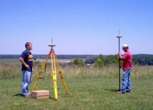
land surveyorsLand surveying is likely one of the world's most vital occupations. It's the only job qualified to form new property boundaries. Moreover, land surveyors also play a significant part in the construction of incredible architectural accomplishments – from the historical achievements that are ages old to the impressive buildings today. As a matter of fact, three of the gents on Mount Rushmore are land surveyors themselves.

Geographic Information System or GIS experts and staff rely upon surveyors for mapping details. The task of your land surveyor has shaped the world as we know it; and it all starts off with small survey markers. It might be merely a small orange survey marker, but this mark is one of the millions that the surveyor uses to take detailed measurements that would become maps which will someday become amazing buildings, new roads, master planned communities, or entire cities – and in each step along the way is a surveyor.

Land surveyors specialize in many positions:

Photogrammetric surveying

In the Office, photogrammetric surveyors deal with cutting-edge software and state of the art machine.

Boundary Surveying

These are land surveyors who do in depth reference research studying maps and boundaries spanning centuries.

Construction Surveying

Within the area, construction surveyors are the power behind any growth; these people team up with engineers to ensure that the structures are constructed within its area and coincide with the type of land where it's built on.

Hydrographic surveying

Hydrographic surveyors take their work to the lake or sea, determining depths, borders, and a lot more. Geodesy involves surveying where you can acquire specific dimensions for satellite.

Land Surveyors may also find themselves inside the court room. They also perform a vital role in providing expert testimonies with regards to boundaries or even in assisting crime scene cases which involves land.

Qualifications of land surveyors

With merely a high school diploma, anyone can begin as a surveyor, an on the job training that would last for just six weeks, field training, and union apprenticeship. However, a lot of land surveyors are degree holders. Local community universities may offer programs or a two year comprehensive program in land surveying. Incomes tend to be greater than average career fields that need a 4 year college diploma or if these people acquire a degree or higher, they could begin management or one of the many specializations.

Posted in blog, land surveying | Tagged Land Surveying, land surveyor, land surveyors

What Is A Land Surveyor?

Daphne Land Surveying Posted on January 28, 2017 by AdminDaphneLSDecember 31, 2017

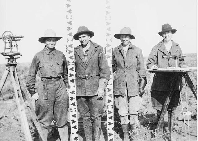
All Female Survey Crew 1918 - Land Surveyors | Daphne Land Surveying

In addition to the four ladies pictured above, some very famous people in history have practiced surveying. Three surveyors and another guy are depicted on Mt. Rushmore (Presidents George Washington, Thomas Jefferson and Abraham Lincoln were all three surveyors, Teddy Roosevelt was not.) Others were Daniel Boone, Meriwether Lewis and William Clark (Lewis & Clark), Sir George Everest, Charles Mason & Jeremiah Dixon (of the Mason-Dixon Line fame) and author Henry David Thoreau practiced for a time in Concord, Massachusetts.

A land surveyor is a professional person with the academic qualifications and technical expertise to measure and plot the lengths and directions of boundary lines and the dimensions of any portion of the earth’s surface (including natural and other structures.) That definition is quite a mouthful, but in actuality the field of surveying (geomatics) includes many other facets.

For the home-owner the surveyor is the person who locates the boundary of your property and the location of your home within that boundary to determine if there are any encroachments by your neighbors onto you or vice versa. Common encroachments are fences, driveways, etc.

These days land surveyors in the United States are regulated and licensed by the various state governments. In Alabama, the Alabama State Board of Licensure for Professional Engineers and Land Surveyors was established in 1935 to protect the public by helping “to safeguard life, health, and property, and to promote the public welfare by providing for the licensing and regulation of persons in the practices of engineering and land surveying. This purpose is achieved through the establishment of minimum qualifications for entry into the professions of engineering and land surveying, through the adoption of rules defining and delineating unlawful or unethical conduct, and through swift and effective discipline for those individuals or entities who violate the applicable laws or rules.”

As of 2007, newly licensed surveyors are required to have a four year degree in surveying or a closely related field and an additional four to eight years of on-the-job training under a licensed surveyor. Licensed Land Surveyors are also required to attend 15 hours of continuing education each year to maintain and update their professional knowledge and skills.

In preparation for a typical lot or mortgage survey of your house, a surveyor may review tax maps, aerial maps, deeds, subdivision plats, zoning ordinances, subdivision regulations and possibly flood maps. For a typical lot survey the subdivision plat is the most important of these because it gives the exact dimensions of your lot and the relative location of your property corners. The surveyor uses this to locate and/or re-establish your property corners.

In the field the survey crew will search for your property corners along with some of your neighbors corners if yours can’t be found, measure the distances and angles between all of the points, locate the improvements on your property, including your house, pool, out-buildings, retaining walls, fences, driveways and sidewalks, etc. Other improvements like sanitary sewer mains, storm drainage ways, overhead power lines and the like are located because these might indicate an easement across the property. The plat should show these, but may not in all cases.

Once all of the field information is gathered, the crew chief takes the field notes and prepares a preliminary sketch of the work. This is passed along to a draftsperson who prepares the final drawing for your use. The draftsperson will check all of the maps mentioned earlier to make sure that all building setback lines and easements are shown on the drawing. The surveyed distances and directions are compared to the plat distances and directions also. Any discrepancies or encroachments are shown on the drawing. Your attorney uses the drawing to determine if any other legal work is needed during the closing. The mortgage company or bank uses the survey to insure they are loaning you money on the correct property.

So now, what do you have for your money. You have a drawing which shows your house on your lot. You should have stakes and/or flagging by all of your property corners. Make sure you know where they are located. The actual corner is marked by an iron pin or pipe of some sort. (The type of monument should be shown on your survey drawing.) You might also want to take a look for them at least once a year to make sure they’re still there. (Even animals mark their territory more often than that.)

For more specific information about what type survey you need, please call Daphne Land Surveying at (251) 270-4140 or better yet send us a contact form request.

Posted in blog, land surveyor | Tagged land survey, Land Surveying, land surveyor, surveyor

Post navigation

← Older posts

Contact Us Now

    Categories

    • blog
    • elevation certificate
    • flooding
    • GPS
    • land surveying
    • land surveyor
    © Copyright Daphne Land Surveying
    Daphne, Alabama 36526
    Phone: (251) 270-4140

    Privacy Policy | Terms of Use

    Web Development and SEO by:
    AuburnBusiness.com

    The owner of this website, USA Surveying & Engineering, LLC., provides coordination of professional land surveying and engineering services in all 50 states. The professional surveying and engineering services provided to you will be conducted by fully licensed professionals in your state.

    Privacy Policy
    ↑