Flood Survey Needs When a Property Falls Near FEMA A or AE Zones
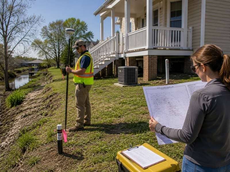
A flood survey provides accurate elevation measurements for properties located in or near FEMA flood zones. When a property falls near FEMA Zone A or AE boundaries, a flood map alone cannot show how high the land sits compared to the expected flood level.
A flood survey measures the property’s elevations and compares them with FEMA flood data. These measurements help determine flood risk and support insurance requirements, permit applications, and building design decisions.
What Does a Flood Survey Actually Measure?
The surveyor collects elevations. Ground elevations across the site, the elevation of the lowest floor of any building, the height of mechanical equipment, and any other point the project requires.
Those measurements then get compared against the current Flood Insurance Rate Map. FEMA publishes these maps, and they sort land into zones by risk level. Zones A and AE both sit inside the Special Flood Hazard Area, which means a one percent chance each year of flooding at or above the base flood level. People call that the hundred-year flood, which is a terrible name. It doesn’t mean once a century. It means a one in a hundred chance every single year.
A map line can slice right through a parcel. Part of your lot can sit in a high-risk zone while the rest sits outside it. On a printed map, that line is a fat stripe covering fifty feet of ground. A survey puts it where it actually falls.
The surveyor doesn’t change the map. They measure what’s there.
How Does a Flood Survey Change in FEMA Zone A and Zone AE?
The letter matters more than most property owners realize.
Zone AE comes from a detailed engineering study, so FEMA publishes a Base Flood Elevation for it. That’s a specific number, the expected height of the one percent flood, and you can measure against it.
Zone A comes from an approximate study. FEMA mapped the risk but never calculated the flood height, so there’s no published Base Flood Elevation at all. You know water is a danger. You don’t know how high.
That gap creates real work. Without a published elevation, an engineer may need to develop one, and the local floodplain administrator may have requirements of their own. Lenders and insurers still want a number, and somebody has to produce it.
So never assume a Zone A property is safer than a Zone AE property because the label looks simpler. It usually means less is known, not that less is at risk.
Why Does the Datum Matter in a Flood Survey?
An elevation number means nothing without knowing what it’s measured from.
A datum is the reference system for height. FEMA maps have been published under different datums over the years, and the two common ones can differ by a foot or more in the same location. Compare a floor elevation measured in one datum against a base flood elevation published in another, and your answer is wrong by that difference.
A foot is not a small error here. Flood insurance rates change with each foot above or below the base flood elevation. A single foot of mistake can cost thousands of dollars a year, or it can put a building below the required height when the owner believes it’s above.
So the surveyor should state the datum on the drawing, plainly, and confirm which datum the effective flood map uses. When they differ, a proper conversion has to happen. This is the most common source of flood elevation errors, and it’s entirely preventable.
How Does a Flood Survey Change Near Coastal Flood Zones?
Coastal high-hazard areas carry a different letter and a different set of problems. Zones V and VE face flooding plus wave action, and waves damage buildings in ways that standing water does not. Zone VE publishes a base flood elevation. Basic Zone V often does not, mirroring the A and AE split.
Coastal work usually expands the survey scope. The crew may need details on the grade under an elevated structure, the location of the zone boundary across the parcel, and the elevation of the lowest horizontal structural member rather than the floor itself. That last distinction matters, because coastal construction rules measure to the bottom of the beam, not the top of the floor.
Treating a coastal site like an ordinary inland elevation check produces the wrong data and a rejected form. Tell the surveyor what zone you’re near before the crew heads out.
Is a Flood Survey the Same as an Elevation Certificate?
Not quite, and the difference trips people up.
An Elevation Certificate is a specific FEMA form. A licensed surveyor completes it, and insurers and floodplain administrators read it. Getting one usually requires a flood survey, since the form is built from measured elevations.
But a flood survey can serve other purposes too. An owner studying whether a site can be built on doesn’t need the form. They need to know whether the planned building area sits above or below the flood level, where the low ground drains, and how the elevation changes across the parcel. That’s a feasibility question, and the answer shapes the whole project.
So tell the surveyor what the data is for. An Elevation Certificate, a permit application, a design study and an insurance review all pull different points, and ordering the wrong scope means paying twice.
Frequently Asked Questions
What Is a Base Flood Elevation?
It’s the height floodwater is expected to reach during a flood with a one percent chance of happening in any given year. Zone AE properties have a published number. Basic Zone A properties often don’t, which is why they take extra work.
Can a Flood Survey Remove My Property From a Flood Zone?
A survey alone can’t, but it’s the first step. When your ground actually sits above the base flood elevation, a surveyor can prepare the elevation data supporting a Letter of Map Amendment, and FEMA decides whether to remove the property from the mapped hazard area. The process belongs to FEMA. The measurements come from your surveyor.
Why Do Flood Insurance Rates Depend on Elevation?
Because risk does. A building sitting well above the base flood elevation floods far less often than one sitting below it, and rates reflect that. Every foot counts, which is exactly why the datum has to be right.
Does the Whole Property Have to Be in the Flood Zone?
No. Flood zone lines regularly cut across a single parcel, leaving part of it inside the hazard area and part outside. A survey shows exactly where that line lands, and it sometimes reveals that the building itself sits outside the zone even when the lot doesn’t.
Should I Order a Flood Survey Before Buying Land?
If the parcel sits anywhere near a mapped flood zone, yes. Elevation drives what you can build, where you can build it, what insurance costs and whether a lender will finance the deal. Finding that out after closing is an expensive way to learn.