
Topo Survey Findings That Can Change a Site Design Budget
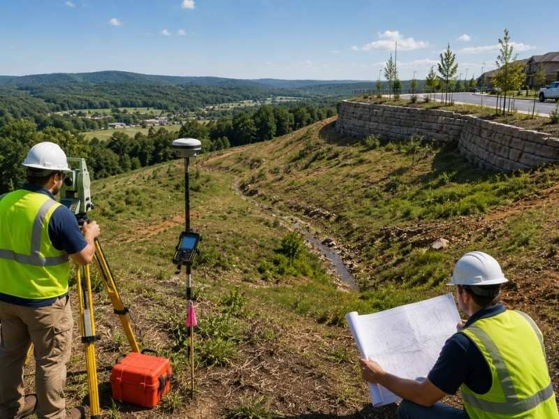
A topo survey provides the detailed elevation and terrain data engineers need before designing a site. The findings from a topo survey can significantly affect a project budget by revealing slope, drainage patterns, cut and fill quantities, and other conditions that influence construction costs.
Site budgets rarely increase because of the design itself. They usually increase during construction, when contractors discover unexpected grading, retaining walls, stormwater improvements, or other site conditions that were not identified early. A topo survey helps uncover these issues before design decisions are finalized, giving the project team time to adjust the layout and control costs.
How Does a Topo Survey Reveal Costly Site Slopes?
Ground that looks flat usually isn’t. Contour lines reveal subtle changes in elevation that are nearly invisible to the eye but can have a major impact on a project budget.
Slope drives earthwork, and earthwork gets priced by the cubic yard. Every yard of soil moved costs money to excavate, haul, place and compact. A site needing 5,000 yards of cut is a different project than one needing 50,000, and the difference between those two numbers can hide entirely behind a gentle grade nobody measured.
Steep areas hit harder still. Once a slope gets too aggressive to grade out, the design starts reaching for retaining walls, and walls are expensive per linear foot. Add engineering, drainage behind the wall, and sometimes railings on top.
The good news: catching slope early gives the design team options. Shift the building pad uphill. Rotate the layout. Step the site instead of leveling it. All of those choices stay open while the plans are still drafts, and all of them close once the drawings are final.
How Does a Topo Survey Calculate Cut and Fill Balance?
Cut means digging soil out. Fill means bringing soil in. A balanced site uses the material from the cut areas to fill the low areas, so nothing gets hauled off and nothing gets trucked in.
Balance is where the money hides. Hauling dirt off site costs money per load, every load. Importing fill costs even more, since you pay for the material and the trucking. A design that misses balance by 10,000 yards can add a genuinely painful number to the budget before anyone pours a footing.
The engineer calculates that balance from the existing surface model, which comes from the topo survey. Feed the model bad ground data and the calculation is wrong from the start. Contractors bid against that number. Owners plan against it. And nobody finds out it was wrong until the trucks start rolling.
One warning worth saying plainly. A topo survey shows the shape of the ground, not what’s under it. Rock, unsuitable soil and buried debris all change earthwork costs dramatically, and only a geotechnical investigation finds those. Order both.
How Can a Topo Survey Identify Drainage Costs?
Water is the most expensive thing on a site that nobody plans for.
When a survey maps an existing ditch or a defined drainage path crossing the parcel, that feature usually has to be accommodated. Crossing it means culverts or pipes. Relocating it means grading work plus a possible permit. Building over it is generally not an option.
Off-site runoff makes this worse. A ditch carrying water from land you don’t own has to keep carrying it, and the pipe you install has to handle that flow, not just the flow your own site generates. Sizing for upstream drainage area can double the cost of a storm system.
Then there’s detention. Many jurisdictions require a project to hold stormwater on site and release it slowly, and a detention basin eats real acreage. That land comes out of your buildable area, which means the survey data indirectly determines how many units, spaces or square feet the site can hold.
What Existing Features Does a Topo Survey Identify?
A survey locates what’s already there, and some of it can’t move.
Big trees, if local rules protect them. Old slabs and foundations that cost money to break out and haul away. Wells and septic fields that carry required setbacks. Overhead lines with clearance requirements. Utility structures that would cost more to relocate than the whole survey.
Each of these carves into the usable ground. Enough of them and the design gets pushed onto a worse part of the parcel, usually the part with more slope, which loops right back to the earthwork budget.
Tell the surveyor what you’re building before the crew goes out. A scope written for the wrong project misses the features that matter, and a second mobilization costs money that a clear conversation would have saved.
When Does a Topo Survey Pay for Itself?
Early. That’s the entire answer.
The value of ground data is highest before anyone commits to a layout, because changing the design costs nothing but a designer’s time. Once a site plan is engineered, permitted and bid, every change carries a fee, a delay, or both.
So the sequence that saves money looks like this. Survey the site. Study the terrain. Compare two or three layouts against the real ground. Then design.
The sequence that costs money is the common one. Design the site from an aerial image and a hopeful assumption, then survey it, then discover the pad sits in the low spot.
Frequently Asked Questions
Will a Topo Survey Give Me a Construction Budget?
No, and no surveyor should pretend otherwise. The survey supplies the measured ground data. Engineers and contractors turn that data into quantities and prices. What the survey does is make those numbers trustworthy instead of speculative.
Which Findings Raise Site Costs the Most?
Earthwork imbalance is usually the biggest, followed by retaining walls, drainage crossings and stormwater detention requirements. Steep ground drives most of these at once, which is why slope deserves the most attention early on.
Does a Topo Survey Show Soil Conditions?
It doesn’t. Soil borings and geotechnical testing answer that, and they matter enormously, since rock or poor soil can wreck an earthwork budget built on clean topo data. Run both studies before finalizing a layout.
Can the Design Change After a Topo Survey?
That’s the point of doing it early. Engineers regularly shift buildings, roads, drainage and grades once they see the actual terrain, and those adjustments cost almost nothing while the plans are still in progress.
Is It Cheaper to Survey Only Part of the Site?
Sometimes, but be careful. Off-site drainage, adjoining grades and tie-in points often sit outside the property line, and a survey that stops at the boundary can miss the very thing that drives the storm design. Talk through the limits with your engineer before trimming the scope.