
Elevation Survey Red Flags on Lots That Look Flat From the Road
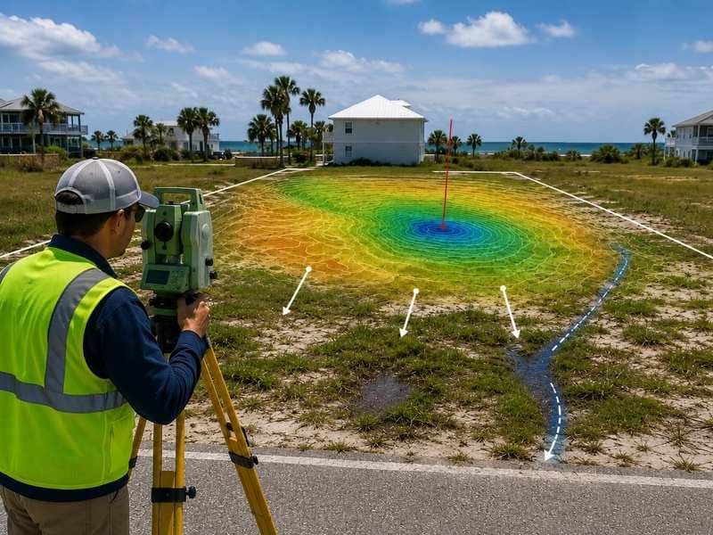
A lot might look flat when you drive past it. From the road, everything seems level and fine. But an elevation survey often finds hidden problems that your eyes cannot see. Coastal lots especially hide dangerous low spots. An elevation survey shows where water sits, where flooding happens, and where building becomes risky. In some cases, flood surveys provide additional information about flood hazards before development begins.
Why Elevation Surveys Find What Your Eyes Miss
Walking a lot feels flat when the ground slopes gradually. Your feet do not notice small changes in height. A drop of two or three feet across a large lot feels invisible. But that small drop changes everything about where water goes.
An elevation survey measures the height of the ground at many points. It shows every rise and fall. It creates a map that shows exactly where the high spots and low spots sit. This map reveals problems that a walk-through completely misses.
High-accuracy elevation surveys also show slopes that are hard to see by standing on the property. A one percent slope seems flat to your eye. But a surveyor’s measurements show it clearly. This slope matters for drainage and building codes.
How Elevation Surveys Reveal Hidden Water Pooling
The Low Spots That Collect Rain
Water flows downhill and collects in the lowest areas. On a lot that looks flat, hidden low spots become traps for standing water. These spots flood during heavy rain even if the rest of the property stays dry.
An elevation survey maps exactly where these low spots sit. A builder can see before they break ground whether their building site sits in a future pond. They can see whether a parking lot will hold water. They can see whether drainage will work or fail.
Where Water Wants to Flow
Water doesn’t always flow toward the obvious direction. Accurate drainage planning depends on understanding how subtle changes in elevation affect water movement across a property. An elevation survey shows the actual flow paths. This reveals whether water flows away from buildings or toward them.
Spots That Look Flat Until the Elevation Survey Arrives
Many coastal developers buy lots because they appear level and ready for building. Then the elevation survey arrives with bad news. The lot has low spots that won’t drain. The lot sits lower than nearby flood levels. The lot needs expensive fill or drainage work that wasn’t budgeted.
These surprises happen because flat-looking ground can have serious elevation problems. A lot that looks okay for sixty percent of its area might have a problematic low area where drainage collects. That low area might make the whole site difficult or impossible to build on without major work.
What Elevation Surveys Show About Flood Risk
Hidden Flood Exposure
Coastal flood zones extend further inland than most people realize. An elevation survey shows whether a lot sits above or below flood risk levels. Some lots look safe because nearby properties don’t flood. But elevation data shows whether this particular lot is actually at risk.
Comparing Your Lot to Neighbors
Neighbors’ properties might stay dry during flooding while yours floods. Why? Elevation differences that you cannot see. An elevation survey explains these differences. It shows whether your lot is higher or lower than the surrounding area. This matters for flood insurance and building costs.
Why Walking a Lot Misses What Elevation Surveys Find
Your eyes judge flatness by looking at a small area at a time. You cannot see the overall pattern. You cannot see whether the lot slopes one direction or another across a large distance. You cannot see small changes that add up to big problems.
An elevation survey measures the entire lot systematically. It gathers hundreds or thousands of data points. It shows exactly where every rise and fall occurs. This complete picture catches problems that a person walking the property will never notice.
An elevation survey also creates permanent records. You can review it months later. You can share it with engineers, builders, and lenders. A walk-through creates only memories and notes that are often incomplete or forgotten.
Frequently Asked Questions
What is an elevation survey used for?
An elevation survey measures how high or low the ground is at different spots on a property. This reveals where water collects, where flooding happens, and where building becomes difficult.
Why do flat-looking lots have elevation problems?
Lots that appear flat to your eye often have small slopes and low spots that elevation surveys reveal. A difference of just a few feet across a large lot creates drainage problems but looks flat when you stand on it.
Can I tell if a coastal lot will flood without an elevation survey?
Walking the property is not reliable. Elevation surveys measure exactly whether the lot sits above or below flood levels. This lets you know the actual flood risk instead of guessing.
How much does an elevation survey cost?
Elevation surveys vary in price based on lot size and detail needed. But the cost is usually much less than discovering problems after you buy or start building.
Should I get an elevation survey before or after making an offer?
Getting an elevation survey before making an offer is smarter. It shows you whether the lot is actually suitable. If the elevation survey finds problems, you can renegotiate the price or walk away before you commit money.