LiDAR mapping lets surveyors collect detailed elevation data across large parcels far faster than ground surveying alone. Instead of walking hundreds of acres and measuring the terrain point by point, a LiDAR system can capture millions of elevation measurements in a single flight or scanning session.
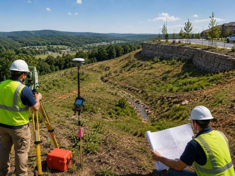
That speed makes LiDAR mapping a strong tool for topo survey work on big properties. It doesn’t replace every part of a land survey, though. Dense vegetation, boundary determination and certain ground features still demand field verification by a survey crew.
How Does LiDAR Mapping Actually Work?
A LiDAR sensor fires laser pulses at the ground and times how long each one takes to bounce back. Time equals distance. Millions of those distance measurements, tied to a known sensor position, become a point cloud, which is exactly what it sounds like: a dense cloud of points with real coordinates and real heights.
The clever part is what happens when a pulse hits a tree. One laser pulse can produce several returns. The first might bounce off the top of the canopy. The next might hit a branch halfway down. The last one, if it finds a gap in the leaves, reaches the actual dirt.
That last return is what a surveyor wants. Everything else is noise, and separating the two is the entire job.
Why Vegetation Affects LiDAR Mapping Accuracy
Here’s the part that catches property owners off guard. LiDAR doesn’t see through leaves. It shoots between them.
A pulse needs a physical gap to reach the ground. Open pasture returns nearly perfect data. A stand of pine with a bare forest floor works well too, since the pulses slip between the trunks. But dense understory changes everything. Thick brush, briars and tall grass block the pulses before they reach soil, and the scanner ends up mapping the top of the vegetation instead of the ground beneath it.
Season matters enormously for this reason. Hardwood forests in winter, with the leaves down, let far more pulses through than the same woods in July. Anyone planning a scan of wooded ground should think hard about timing, because a summer flight over dense canopy can produce data nobody can use.
So the honest answer on heavy brush is that LiDAR mapping struggles. Crews still have to walk it.
Which Type of LiDAR Mapping Fits the Job?
Three collection methods dominate, and each one suits a different site.
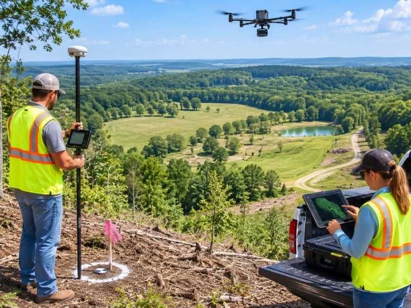
Aerial LiDAR flies the sensor over the property, either on a small aircraft or a drone. It covers ground fast, which makes it the default for large parcels, long corridors and anything measured in hundreds of acres. Drones handle mid-sized sites well. Aircraft make sense when the area grows large enough that flight time stops being the bottleneck.
Terrestrial LiDAR puts the scanner on a tripod. The crew sets it up, scans, moves it, scans again. Accuracy is excellent and detail is extraordinary, which is why it works so well on buildings, bridges, tight construction sites and anywhere you need to capture a structure rather than a landscape. Coverage is slow, though. Every setup takes time.
Mobile LiDAR mounts the sensor on a vehicle. It shines on roads, rail lines and anything you can drive along, capturing everything within range as the truck moves.
Most large-parcel work uses aerial. The other two show up when the project demands detail that flying can’t deliver.
How Is LiDAR Mapping Data Processed After Collection?
A raw point cloud is not a survey. It’s a heap of tens of millions of points, and most of them are useless for terrain.
Point classification is the cleanup. Software sorts the points into categories: ground, vegetation, buildings, water, vehicles, noise. Then a technician reviews the result, because automated classification makes mistakes. It mislabels a low berm as brush. It calls a flat rooftop bare earth. Somebody has to catch that.
Only the ground-classified points build the digital terrain model. Everything else gets set aside.
This step is where cheap LiDAR work goes wrong. A vendor can hand you a beautiful point cloud, technically accurate, that produces a garbage terrain surface because nobody spent the hours cleaning it. Ask what the classification process looks like and who reviews it before you compare quotes.
What LiDAR Mapping Cannot Do
Two limits deserve saying plainly, because people misunderstand both.
LiDAR mapping cannot establish a boundary. A scanner maps surfaces. It doesn’t read deeds, search for buried monuments, weigh conflicting evidence or make the professional judgment that boundary work requires. A point cloud can show where a fence sits, but only a licensed surveyor can tell you where the property line sits. These are entirely different tasks, and no amount of scanning resolution changes that.
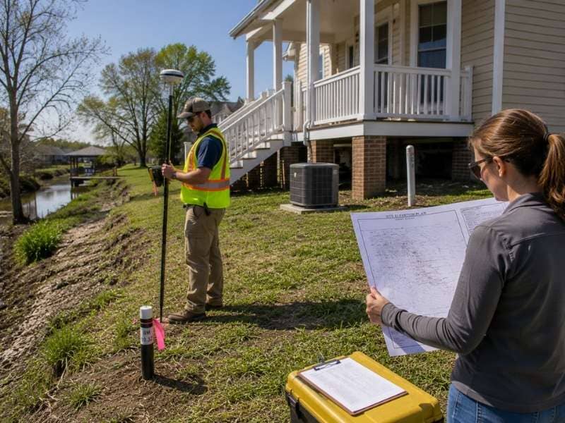
LiDAR also misses features that matter for design. A pipe invert sitting inside a culvert. The exact top of a wall corner. A valve box hidden under grass. These get captured by a crew with a rod, or they don’t get captured at all.
So the strong workflow on a large parcel is a hybrid. Scan the broad terrain, then send a crew to pick up the boundary, the control, the hidden features and the details the design team specifically needs. The two methods cover each other’s weaknesses instead of competing.
Frequently Asked Questions
What Is a Point Cloud?
It’s the raw output of a LiDAR scan, made up of millions of individual points that each carry a position and an elevation. Together they form a three-dimensional picture of everything the laser hit, including ground, trees, buildings and anything else in the way.
Can LiDAR Mapping See Through Trees?
Not exactly. Individual pulses slip through gaps in the canopy and reach the soil, and those returns become the ground data. Dense brush and heavy summer foliage block far more pulses, so results depend on the vegetation and often on the time of year the scan happens.
Does LiDAR Mapping Replace a Boundary Survey?
No, and it can’t. Boundary determination requires deed research, monument recovery, evidence analysis and the judgment of a licensed surveyor. LiDAR maps surfaces. It has no opinion about property lines.
Is LiDAR Mapping Cheaper Than a Field Crew?
On large open parcels, usually yes, since one flight replaces weeks of walking. On small sites the setup and processing costs can outweigh the savings, and a crew simply gets there faster. Acreage and ground cover decide it.
How Accurate Is LiDAR Mapping Data?
Accuracy depends on the sensor, the collection method, the flight or scan plan, the ground cover and the quality of the control tying it all together. Terrestrial scanning is the most precise. Aerial data over open ground performs well. Aerial data over heavy brush can be significantly off, which is exactly why field checks still matter.