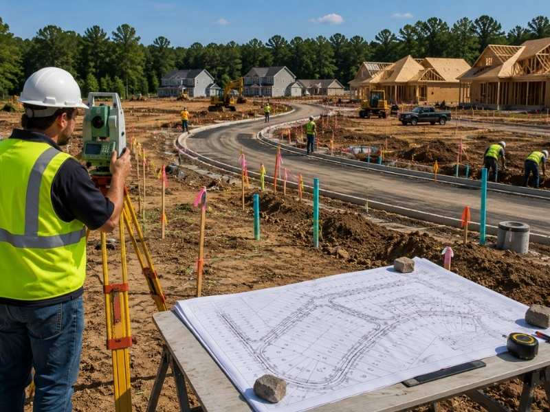
An elevation survey tells you the exact height of your yard, your house, and the ground where a new project will sit. That data can save you from a problem before you build an addition, put in a pool, or set up an outdoor kitchen. Water can pool in the wrong spot if nobody checks the height first.
What an Elevation Survey Confirms Before You Build
An elevation survey checks the height of the ground at key points on your land. A surveyor measures your home’s floor level. They measure the yard around it too. They also check any spots where a new project might change how water moves. Those numbers become the starting point for planning any addition, pool, or outdoor space. The new work fits the ground instead of fighting it.
This step matters most when a project sits close to your home. A patio, a deck, or a small addition can end up too high or too low by just an inch. That small gap can send water toward your house instead of away from it. An elevation survey catches that risk before the first shovel goes in the ground.
Matching New Additions to Your Home’s Existing Height
A room addition has to line up with the rest of your house. That means matching floor heights closely. If the new slab sits too low, water can pool against the wall where the old and new sections meet. If it sits too high, the doors and roof lines won’t line up right.
An elevation survey gives your builder the exact numbers to set the new floor at the right height. That keeps the roofline even. It also keeps the space between old and new smooth, both inside the home and outside where the two foundations meet.
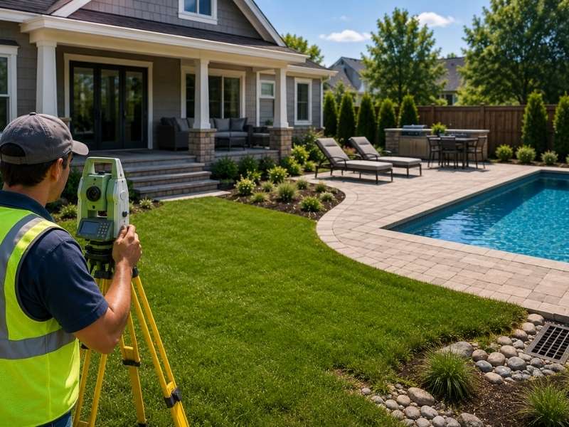
Keeping Pools and Patios Draining the Right Way
A pool changes how water moves across your whole yard, not just the spot where it sits. The deck around a pool has to slope a bit away from the water. It also has to slope away from your house. That way, rain and splash-out drain where they should, not where they build up near the foundation.
An elevation survey maps out those slopes before the pool goes in. It shows the builder how much the yard already tips one way or another. The new deck can then work with that slope instead of making a low spot that never drains. Getting this step right helps you avoid standing water, soggy grass, and damage near your home later on.
Permit Offices Often Ask for Height Data
Many local permit offices ask for height data before they approve a pool, addition, or big outdoor project. This isn’t always about flood risk. Offices often want proof the new work won’t push water onto a neighbor’s yard or trap it against your own home.
An elevation survey gives you exact, written numbers to send in with your permit papers. That paperwork moves the approval along faster than a rough guess ever could. Skipping this step can mean delays later, once an inspector asks for numbers nobody measured up front.
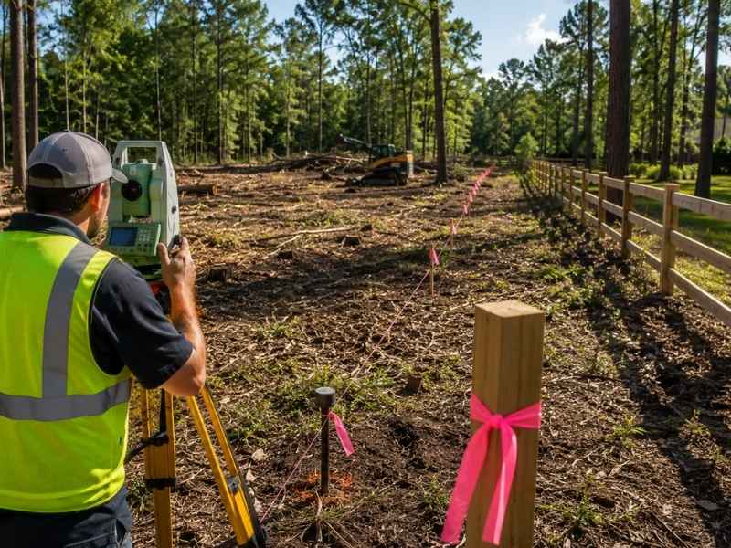
Outdoor Living Spaces Need Elevation Checks Too
Decks, fire pits, and outdoor kitchens sit outside, but the ground under them still needs the same kind of check. Uneven ground under a deck can lead to a structure that never sits quite level, no matter how careful the build.
A fire pit or outdoor kitchen built on the wrong grade can end up collecting water after every rain. An elevation survey flags spots like these ahead of time. The ground gets prepped the right way before any concrete gets poured or any structure goes up. This small step now saves you from a project that looks fine at first, then settles or floods within a year or two.
Grading almost always comes first on a checklist like this. A builder who skips the height check on a fire pit or outdoor kitchen may not notice the problem until the first hard rain. Fixing the grade under a finished structure costs far more than checking it up front would have.
Frequently Asked Questions
What is an elevation survey?
An elevation survey is fieldwork that measures the height of the ground and nearby structures at set points on your property. Surveyors use this data to guide additions, pools, and outdoor projects. The new work matches the ground around it and drains the right way.
Do I need an elevation survey for a pool?
Yes, in most cases. A pool changes drainage patterns across your whole yard. An elevation survey shows how water already moves. The deck and pool area can then be built to drain the right way instead of collecting water near your home.
How does an elevation survey affect drainage?
An elevation survey shows exactly how your yard slopes right now, before any new work changes it. That data lets a builder plan grading and drainage for a new project. Water keeps moving away from your house instead of pooling near the foundation.
Is an elevation survey required for permits?
Often, yes. Many permit offices want written height data for pools, additions, and big outdoor projects. They need proof the work won’t cause drainage problems for your property or a neighbor’s.
What’s the difference between an elevation survey and an elevation certificate?
An elevation survey measures ground and structure heights for building and drainage plans on projects like additions and pools. An elevation certificate is a different document. It compares your home’s height to local flood levels for insurance. The two serve different goals, even though the names sound alike.