↓
 

Daphne Land Surveying

...a Brandon Bailey, PLS website.

Daphne Land Surveying - Brandon Bailey header
Daphne Land Surveying
  • Home
  • Land Surveying
  • ALTA Title Survey
  • Boundary Survey
  • Construction Survey
  • Drone LiDAR Mapping
  • Lot Survey
  • Elevation Certificate | Flood Survey
  • Flood Survey
  • Blog
  • Contact Us
Home - Page 4 << 1 2 3 4 5 6 … 14 15 >>

Post navigation

← Older posts
Newer posts →

Boundary Survey Clues That Help Settle Fence Line Confusion

Daphne Land Surveying Posted on June 25, 2026 by AdminDaphneLSJune 23, 2026
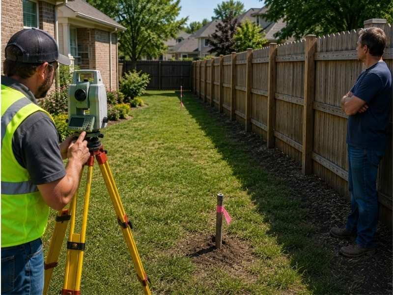
Boundary survey showing property markers and a fence line to help homeowners resolve fence line confusion

A fence that sits a few feet off the property lines can cause real problems between neighbors. Sometimes no one even knows there is a problem until someone checks. A boundary survey is the tool that shows where the property line actually is, not where someone guessed it was years ago. If there is confusion about a fence, this is usually where the answer starts.

How a Boundary Survey Shows Where the Property Line Really Is

A boundary survey finds the true location of a property line by using legal records and precise field measurements. It tells property owners exactly where their land begins and ends, which is often different from where a fence is standing.

Surveyors pull the legal description of the property from recorded documents. They compare that description to what they find on the ground. When those two things don’t match, it shows up clearly in the survey results. That gap between the legal line and the actual fence is what causes most neighbor disagreements.

A fence might look like it is in the right place. It might have been there for 20 years. But looks and time do not make a fence legally correct. Only a boundary survey can confirm where the line sits.

Why an Existing Fence May Not Match a Boundary Survey

Many fences were built long before modern surveying tools existed. The person who put up the fence may have used rough estimates, paced out the distance by foot, or relied on a neighbor’s word. None of those methods are accurate enough to place a fence exactly on a legal property line.

Even fences built more recently can be off. A contractor might measure from the wrong starting point. An old deed description might be unclear. A corner marker might have been moved or buried over time. Any one of these things can push a fence several inches or even a few feet off the true line.

A boundary survey compares the fence’s actual position to the legal records. It doesn’t rely on what the fence looks like or where it has always been. It uses the recorded legal description, deed history, and physical evidence found on the ground to confirm the correct line.

What Property Markers Tell Surveyors During a Boundary Survey

Property markers are physical objects placed at the corners and edges of a property to mark the legal boundary. They are usually metal rods or pipes driven into the ground. Older properties may have stone monuments or iron pins set during a survey done decades ago.

When a surveyor arrives at a property, finding these markers is one of the first steps. Each marker that can be found and confirmed gives the surveyor a fixed point to work from. The more markers that are found and in good condition, the easier it is to confirm where the full boundary sits.

Markers matter most when fence questions come up because they show the original intent of the property line. If a fence was built two feet away from a confirmed marker, that gap is visible and measurable. The marker doesn’t move. It was placed there to mark the legal corner, and a boundary survey uses it to verify the line.

Some markers get buried under years of soil and grass. Others get knocked out of place by construction equipment or landscaping work. When a marker is missing, surveyors use other evidence to find where it should be. That includes deed records, neighboring surveys, and measurements from known points nearby.

How a Boundary Survey Gives Neighbors Clear Answers

Fence disagreements often start because each neighbor believes they are right. One person says the fence belongs on the left. The other says it belongs on the right. Without a survey, both sides are guessing.

A boundary survey removes the guesswork. It produces a drawing that shows the exact location of the property line and where the fence sits in relation to it. Both neighbors can look at the same document and see the same facts.

That shared set of facts changes the conversation. It’s no longer about what someone remembers or what they think looks right. The survey shows what the legal records and physical measurements say. That’s a much easier starting point for working out a solution.

Surveys also create a paper record. If a question about the fence comes up again years later, the survey documents the line as it was measured at a specific point in time. That record can be useful if the property ever changes hands.

Why Small Measuring Mistakes Can Lead to Fence Problems

An inch doesn’t seem like much. But when a fence runs 150 feet across a property, a small measuring error at the start can put the far end several feet off the legal line. That is enough to place a fence clearly on a neighbor’s property.

These mistakes happen more often than people expect. Someone building a fence might measure from the edge of a sidewalk instead of the actual property corner. They might misread a deed that describes the lot in a confusing way. They might assume the old fence they are replacing was in the right place.

A boundary survey catches these errors before a fence goes up, or documents them clearly after the fact. The surveyor measures from known, confirmed points and works through the legal description step by step. That process finds small errors that a tape measure and a rough estimate would miss entirely.

Fixing a fence after it is built is expensive and often leads to conflict. Getting the line confirmed first is a much simpler path.

Frequently Asked Questions

How can a boundary survey help when there is confusion about a fence line?

 A boundary survey shows the true location of the property line using legal records and field measurements. It tells homeowners whether a fence is placed correctly and removes the guesswork from ownership questions.

Why do some fences not match the property line?

 Some fences were built using rough estimates, old measurements, or unclear deed descriptions. A boundary survey checks the fence position against legal records to show where the property line actually is.

What are property markers, and why do they matter in a boundary survey?

 Property markers are metal rods or pins placed at the corners and edges of a property to mark the legal boundary. Surveyors use them as fixed starting points to confirm where the boundary line sits.

Can a boundary survey help neighbors settle fence disagreements?

 Yes. A boundary survey produces a drawing that shows the legal property line and where the fence sits in relation to it. Both neighbors can review the same facts, which makes it easier to work toward a solution.

Why can small measuring errors cause big fence problems?

 A small mistake at the start of a fence line gets larger as the fence gets longer. A boundary survey measures from confirmed legal points, catching errors that rough field measurements would miss.
Posted in Boundary survey | Tagged boundary survey

ALTA Survey Details That Matter Before a Commercial Site Plan Moves Forward

Daphne Land Surveying Posted on June 24, 2026 by AdminDaphneLSJune 23, 2026
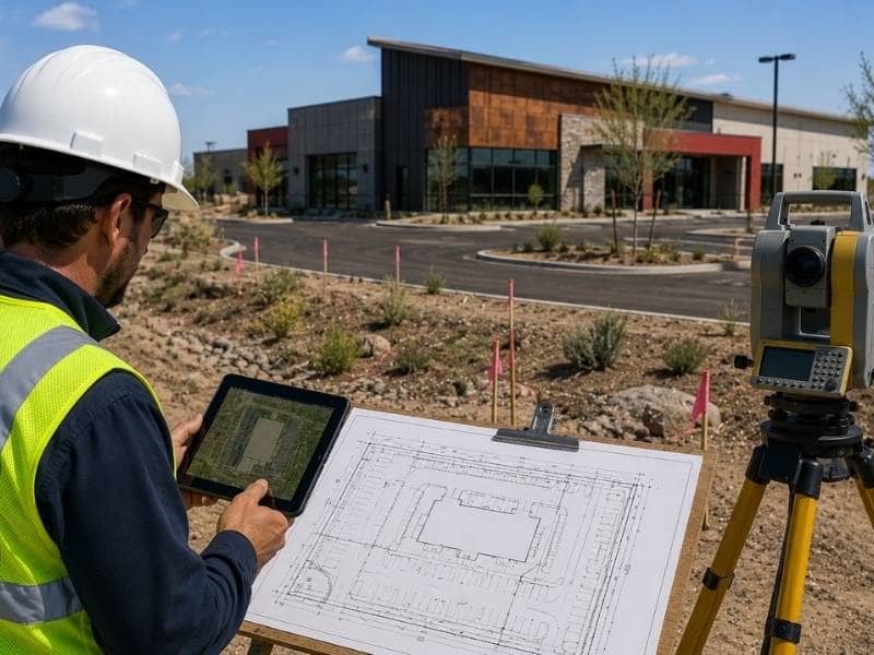
ALTA survey being reviewed for a commercial property before moving forward with a site plan and development design

Before a commercial site plan can start, you need to know exactly what you’re working with. An ALTA survey gives developers that information. It shows property lines, access points, easements, and features already on the land, all checked against legal records. Without it, costly problems tend to show up in the middle of design or permitting.

What an ALTA Survey Shows Before a Site Plan Moves Forward

An ALTA survey is a detailed map of a commercial property. It shows boundary lines, easements, access points, utilities, and existing structures. Engineers, architects, and title companies all use it when planning a project.

Every ALTA survey follows rules set by two national groups: the American Land Title Association (ALTA) and the National Society of Professional Surveyors (NSPS). They updated these rules in 2021. The new rules require surveyors to show more detail about utility easements and property overlaps, which helps developers plan more accurately.

A regular boundary survey doesn’t show nearly as much. It won’t show utility easements, shared access agreements, or overlaps from neighboring properties. Those missing details become problems once a project is already being designed.

What an ALTA Survey Typically Shows

  • Where the property lines are, based on the legal description
  • Easements and rights-of-way on the property
  • Buildings, paved areas, fences, and utilities already on the site
  • Roads, driveways, and curb cuts
  • Any overlaps with neighboring properties

How an ALTA Survey Confirms Property Lines and Site Access

An ALTA survey compares what the legal documents say with what is actually on the ground. It shows exactly where the property lines are and how people and vehicles can get to the site. Developers need this before they decide where to put buildings, parking, and driveways.

Property lines written in a deed don’t always match the lines on the ground. A surveyor checks both and finds any differences. That confirmed line is what engineers use to make sure a building stays within the required distance from the edge of the property.

Access is just as important. A site might look like it has two driveways from the street. But the survey might show that only one has legal permission to be used. The other might cross a neighbor’s land. That one detail can change the whole layout of parking and traffic flow on the site.

Why Easements on an ALTA Survey Can Change Building Plans

An easement gives someone else the right to use part of your property. Utility companies, nearby property owners, and local governments can all have easements. These easements limit where you can build. An ALTA survey puts all of them on the map before design begins.

Easements are written into title documents, but they aren’t always drawn on a map. Under the 2021 ALTA rules, surveyors must mark utility lines as proof of possible easements. This applies even when those easements weren’t in the original title paperwork. It helps developers find buried lines before construction starts.

Common Easements That Affect Commercial Sites

  • Utility easements: usually 15 to 30 feet wide. You can’t build permanent structures above buried lines.
  • Drainage easements: limit grading and paving near stormwater systems.
  • Shared driveway easements: let a neighbor legally cross your property.
  • Sewer and water line easements: limit what you can build above them and require access for repairs.

A 25-foot utility easement cutting across a site can push the whole building in a direction no one planned. Finding it during the survey costs nothing. Finding it during permit review costs weeks.

Why Existing Site Features Matter on an ALTA Survey

An ALTA survey shows what is already on the property: buildings, parking lots, fences, drainage structures, and utilities. Knowing this before design starts helps teams avoid problems between what’s there now and what they plan to build.

Most commercial sites have something on them. There might be an old building, a paved area, or utility lines from a past use. The survey shows where all of it sits compared to property lines and easements.

A building sitting too close to the property line might overlap with a required setback. A parking lot over an easement might need to be partly removed before the new project can get permits. Old utility lines that aren’t mapped can cause accidents during demolition and grading.

The engineer uses the survey for grading and drainage plans. The architect uses it for building placement. The contractor uses it for demolition work. All three need this information before they can start.

Frequently Asked Questions

What information does an ALTA survey provide for a commercial property?

 An ALTA survey shows property lines, access points, recorded easements, existing structures, and utility locations. It follows the 2021 ALTA/NSPS rules, which are the highest standards for land title surveys in the United States.

Why is an ALTA survey important before creating a commercial site plan?

 It shows property details that affect how the project gets designed. Finding boundary issues, access problems, and easements early prevents expensive changes during permitting and construction.

How does an ALTA survey help with property access? 

It maps every road, driveway, and recorded access agreement connected to the property. That tells planners which entry points are legally allowed and how vehicles will move through the site.

Why should developers pay attention to easements shown on an ALTA survey?

Easements limit where buildings can be placed. Under the 2021 ALTA rules, surveyors must mark even unrecorded easements they find in the field. The survey often shows more than the title paperwork does.

What existing site features does an ALTA survey show?

 It shows buildings, parking areas, fences, drainage structures, and utility connections already on the property. That helps the design team understand the current site before planning what comes next.

Posted in alta survey | Tagged alta survey

LiDAR Mapping for Developers Working Near Wetlands, Ditches, or Low Ground

Daphne Land Surveying Posted on June 23, 2026 by AdminDaphneLSJune 23, 2026
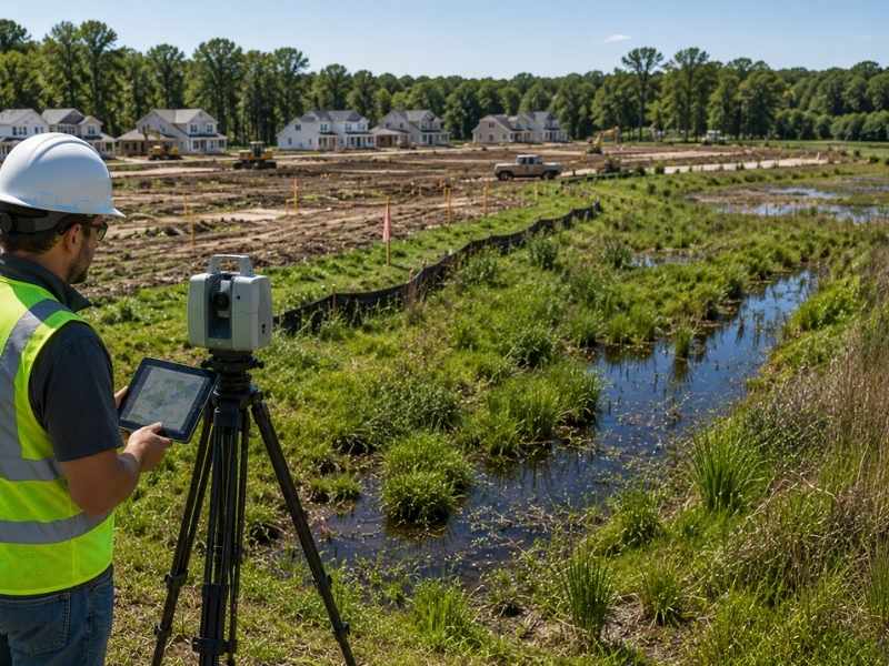
LiDAR mapping used by a land surveyor to evaluate wetlands, drainage ditches, and low ground near a residential development site

A site that looks buildable from the road can shrink fast. Wetlands, ditches and low ground all play a part. LiDAR mapping gives developers that picture early, before money goes into a design the land cannot support.

How LiDAR Mapping Shows Low Areas That May Hold Water

A site plan built on a rough sense of the land runs into trouble fast. Low areas are easy to miss during a walkthrough, and they often shrink the usable part of a site once they show up on paper. LiDAR mapping catches these spots early, while a design can still work around them.

This matters most at the decision stage. Knowing which parts of a parcel hold water changes how many buildable lots a site can support. It also affects where roads should run and how much land needs to go toward drainage instead of structures.

Skipping this step does not make the low ground disappear. It just means the discovery happens later. By then, a design is usually finished and a budget is already set.

Why LiDAR Mapping Matters When Building Near Wetlands

Wetlands are areas where water sits at or near the surface for part or all of the year. Building near them often comes with buffer rules and permitting steps. The rest of a property does not face those steps.

LiDAR mapping helps surveyors see exactly where these areas sit next to the buildable part of a parcel. That detail matters. A wetland edge that looks approximate on an older map can shift how much land actually qualifies for construction.

Knowing this early changes how a project gets designed. A developer who understands the wetland edge early can place buildings, roads and utilities around it from day one. That beats redesigning around it later.

How LiDAR Mapping Helps Developers Understand Drainage Ditches

Drainage ditches carry water away from a site. Many connect to a larger system that serves more than one property. A new development changes how much water reaches that ditch and how fast it gets there.

LiDAR mapping shows exactly where ditches sit and how the land slopes toward them. That detail helps a developer judge whether an existing ditch can handle the added runoff a new project sends its way. The ditch either has room to spare, or it does not.

This question comes up often during review. A ditch that worked fine for an open field may not handle a paved site, since paved ground sends water downhill much faster. LiDAR data gives developers and engineers the detail needed to answer that question early, not after a ditch overflows.

How LiDAR Mapping Supports Coastal Drainage Reviews

Coastal sites carry drainage questions that inland parcels do not face. Tides, storm surge and a high water table can all affect how well a site drains. Reviewers look closely at that detail.

LiDAR mapping gives reviewers detailed elevation data across the whole site. That data supports a more accurate look at how water moves, in routine rain and in big storms. It becomes part of what a drainage review checks before approving a coastal project.

Without that level of detail, a review can stall while reviewers ask for more. Starting with accurate elevation data keeps a coastal drainage review moving. It avoids sending a developer back for extra studies.

How Land Surveyors Use LiDAR Mapping to Study the Shape of the Land

Once LiDAR data is collected, its real value shows up in how developers use it. Contour maps built from that data turn raw elevation points into a clear picture. Slopes, high spots and low spots all show up across the site.

Developers use this picture to compare options before committing to a layout. One building spot might sit on stable, well drained ground, while another nearby could need heavy grading or drainage work to make it usable. That comparison happens on paper, not after construction begins.

This is where LiDAR mapping earns its place early in a project. It gives developers a tool for choosing where to build and where to leave room for drainage. It also flags where construction costs will run higher than they look from the road.

Frequently Asked Questions

How does LiDAR mapping help developers working near low ground?

LiDAR mapping shows small changes in elevation that are easy to miss on a walkthrough. That helps developers see where water is likely to collect before a design gets locked in.

Why is LiDAR mapping useful when building near wetlands?

A wetland boundary affects how much of a parcel actually qualifies for construction. LiDAR mapping shows that boundary clearly enough to plan around it from the start.

How can LiDAR mapping help developers understand drainage ditches?

LiDAR mapping shows how the land slopes toward existing ditches. That helps developers and engineers judge whether the system can handle the runoff a new project will add.

Why are drainage reviews important for coastal development?

Coastal sites deal with tides and storm surge on top of normal rainfall. Reviewers look closely at elevation data to confirm a site will drain properly under those added conditions.

How do land surveyors use LiDAR mapping during site planning?

Surveyors turn LiDAR data into contour maps that show slopes and low spots across a site. That gives developers a clear basis for comparing building locations before committing to a layout.

Posted in LiDAR mapping | Tagged lidar mapping

Post navigation

← Older posts
Newer posts →

Contact Us Now

    Categories

    • alta survey
    • blog
    • Boundary survey
    • construction staking
    • elevation certificate
    • flooding
    • GPS
    • land surveying
    • land surveyor
    • LiDAR mapping
    • Topo Survey
    © Copyright Daphne Land Surveying
    Daphne, Alabama 36526
    Phone: (251) 270-4140

    Privacy Policy | Terms of Use

    Web Development and SEO by:
    AuburnBusiness.com

    The owner of this website, USA Surveying & Engineering, LLC., provides coordination of professional land surveying and engineering services in all 50 states. The professional surveying and engineering services provided to you will be conducted by fully licensed professionals in your state.

    Privacy Policy
    ↑