
↓
 

Daphne Land Surveying

...a Brandon Bailey, PLS website.

Daphne Land Surveying - Brandon Bailey header
Daphne Land Surveying
  • Home
  • Land Surveying
  • ALTA Title Survey
  • Boundary Survey
  • Construction Survey
  • Drone LiDAR Mapping
  • Lot Survey
  • Elevation Certificate | Flood Survey
  • Flood Survey
  • Blog
  • Contact Us
Home - Page 5 << 1 2 3 4 5 6 7 … 14 15 >>

Post navigation

← Older posts
Newer posts →

Flood Survey Problems That Can Delay Insurance or Financing

Daphne Land Surveying Posted on June 19, 2026 by AdminDaphneLSJune 16, 2026
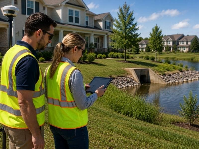
Flood survey review near a residential drainage area with professionals checking property data before insurance or financing approval.

A flood survey can hold up an insurance policy or a loan in ways most homeowners don’t expect. The problems are rarely about flood risk itself. They usually come from the paperwork. Missing details, conflicting records, or old information can all stop a review before it finishes. Knowing what causes these delays makes it easier to catch problems early and fix them before they affect a closing date or a policy renewal.

Property Records That Do Not Match Can Cause Delays

A flood survey pulls information from several sources. These include FEMA flood maps, property deeds, past survey documents, and elevation data. When those sources don’t agree, lenders and insurance companies ask questions before moving forward.

One common problem is when the property description in the deed doesn’t match what the flood map shows. Another is when an older survey shows a different lot size than current records reflect. These differences don’t always mean something went wrong. Maps and records sometimes get updated at different times. Either way, a mismatch slows things down because the lender needs a clear answer before they can move ahead.

Unclear Flood Zone Lines Can Create Problems

Some properties sit right on the edge of a flood zone boundary. The line between a high-risk area and a lower-risk area runs close to or across the lot. When that happens, lenders look closely at exactly where the property falls.

If the flood survey doesn’t clearly show where the structure sits in relation to that line, the lender may treat the property as if it falls in the higher-risk zone. That can trigger a flood insurance requirement the buyer wasn’t expecting. A flood survey that clearly maps where the property sits relative to the flood zone boundary gives the lender the answer they need without extra back-and-forth.

Home Changes May Make Old Survey Data Outdated

FEMA uses specific measurements to decide how a property relates to flood risk. One of the most important is whether any part of the home sits below the Base Flood Elevation for that area. When a homeowner adds an enclosed garage, a sunroom, or a lower-level space after the original survey was done, that new area can change how the property gets reviewed.

An older flood survey that doesn’t include the new addition gives an incomplete picture. Lenders and insurance companies reviewing that document don’t know about the change. When they find out, they ask for updated information. That request stops the process while a new survey gets ordered and submitted. Updating the flood survey after major improvements avoids that delay.

Questions From Lenders Can Slow Down the Process

Lenders follow specific rules when it comes to flood risk. If a flood survey is missing required fields, shows conflicting data, or doesn’t include the right documents, the lender sends a request for more information. That request goes back to the homeowner, who then has to contact the surveyor and wait for a corrected document.

Each round of back-and-forth adds time. In a home purchase, that time comes out of the closing schedule. In a refinance, it delays when the new loan takes effect. A flood survey that is complete and accurate from the start moves through the lender’s review without those interruptions.

Checking Flood Survey Records Early Can Prevent Surprises

The best time to look at a flood survey is before starting an insurance application or a loan process. Buyers can ask for the existing flood survey documents during the review period and check them for missing fields or old information.

Homeowners who plan to refinance or renew a flood policy can do the same thing a few months early. If something looks off, there is time to order an updated survey without pressure. Waiting until a lender or insurance company finds the problem means fixing it under a deadline, which is harder than catching it ahead of time.

Frequently Asked Questions

What is a flood survey?

A flood survey provides information about a property’s elevation and its relationship to flood risk areas. Lenders and insurance companies use it to understand how a property relates to FEMA flood zones.

Why do lenders review a flood survey?

Lenders use flood survey information to confirm where a property sits relative to flood risk areas before approving a loan. Properties in high-risk zones may require flood insurance as part of the loan.

Can home improvements affect a flood survey?

Yes. Additions like enclosed garages or lower-level spaces can change how a property relates to flood risk measurements. An older survey that doesn’t include those changes may no longer be accurate.

Can flood zone lines affect insurance requirements?

Yes. A property that sits near a flood zone boundary may face different insurance requirements depending on where the structure falls. A clear, accurate flood survey removes that uncertainty.

How can I help avoid delays with a flood survey?

Review your flood survey documents before applying for insurance or financing. Make sure all fields are complete, the information reflects current property conditions, and the records match your deed and other documents.
Posted in elevation certificate | Tagged flood survey

Topo Survey Data Builders Need Before Grading a Sloped Lot

Daphne Land Surveying Posted on June 18, 2026 by AdminDaphneLSJune 16, 2026
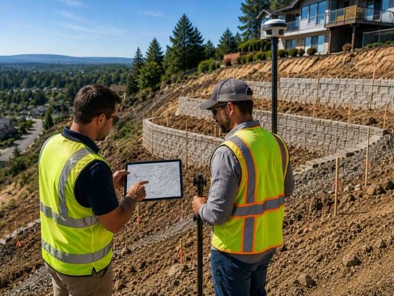
Topo survey review on a sloped lot showing surveyors checking grade data before retaining wall and grading work.

Grading a sloped lot is not the same as grading flat ground. The land pushes back. Every decision about where to cut, where to fill, and where to build has to work with the natural shape of the site. A topo survey gives builders the elevation data they need to make those decisions before the work starts. Without it, problems that could have been caught early show up in the middle of construction when they cost the most to fix.

How Slope Affects Retaining Wall Placement and Design

When a lot drops significantly from one end to the other, retaining walls often become part of the plan. They hold soil in place, create usable flat areas, and protect foundations from shifting ground. But putting a retaining wall in the wrong spot, or designing one without knowing the full grade, creates structural problems over time.

A topo survey shows exactly how much the land drops and where that drop happens. Builders use that data to decide how tall a wall needs to be, how many walls the site requires, and where each one should sit. A wall built without accurate elevation data may not hold the right amount of soil or may sit too close to a foundation to work safely. Getting those decisions right starts with knowing the actual grade at every point on the lot.

When Grading Triggers Stormwater Compliance Requirements

Moving soil on a sloped lot changes how water flows across it. What once drained slowly through natural vegetation now moves faster across compacted or exposed ground. In many areas, grading projects that disturb a certain amount of land must meet stormwater management requirements before a permit gets approved.

A topo survey helps builders understand the existing drainage patterns before any soil gets moved. That information feeds directly into the stormwater plan. Engineers use the survey data to calculate runoff rates, size drainage structures, and design swales that handle the increased flow from graded surfaces. Submitting a grading permit without this information often leads to requests for more documentation, which stalls the project before it begins.

How Topo Data Guides Septic System Placement on Sloped Sites

On lots without access to a public sewer line, a septic system has to go somewhere on the property. Sloped lots add complications. The drain field needs enough flat, usable area at the right depth. It also has to sit at a safe distance from the building, the well if there is one, and the property lines. Slope affects all of those relationships.

A topo survey gives the builder and the septic designer a shared picture of the lot. It shows where the usable flat areas are, how deep the grade changes, and whether the planned location for the system is realistic. Placing a septic system in the wrong spot on a sloped lot can fail inspections, require costly relocation, or create long-term drainage issues that affect the whole property. Topo data removes most of that guesswork before the first stake goes in the ground.

How Grade Changes Influence Foundation Type Decisions

Not every foundation works on every lot. A sloped lot often rules out a simple slab-on-grade foundation because the ground drops away too much from one side of the building to the other. In those cases, builders may need a stem wall, a pier-and-beam foundation, or a basement design that accounts for the grade difference.

Each of those foundation types has different cost and construction requirements. Topo survey data gives the engineer the numbers needed to evaluate which type fits the site and design it correctly. A foundation chosen without accurate slope data may need to be redesigned after the permit is submitted or, in worse cases, after excavation begins. Both of those situations add cost and time that topo data gathered early would have prevented.

How Grading Plans Protect Neighboring Properties From Runoff

Grading a sloped lot changes where water goes. On a natural site, runoff spreads out and soaks in gradually. On a graded site with compacted soil and new surfaces, water moves faster and in more concentrated paths. If that water runs toward a neighboring property, it can cause erosion, flooding, or damage that creates legal problems for the builder and the homeowner.

A topo survey shows how the land slopes toward neighboring lots and where runoff currently exits the property. Builders use that data to design grading plans that direct water away from adjacent properties and toward appropriate drainage outlets. Getting this right matters not just for the neighbors but also for permit approval, since many jurisdictions require proof that a grading plan doesn’t increase runoff onto adjacent land.

Frequently Asked Questions

What is a topo survey?

A topo survey is a map that shows the shape of the land and changes in elevation across a property. Builders use it to understand how the ground rises and falls before making grading and construction decisions.

Why do builders need a topo survey before grading a sloped lot?

A topo survey shows the exact grade of the land so builders can plan retaining walls, drainage, foundations, and soil movement before work begins. Without it, builders have to guess, and mistakes on sloped lots are expensive to correct.

Can a topo survey help with stormwater compliance?

Yes. Topo data shows existing drainage patterns and helps engineers design grading plans that meet stormwater permit requirements before construction starts.

Does a topo survey affect foundation decisions?

Yes. The grade data from a topo survey helps engineers choose the right foundation type for a sloped lot and design it correctly for the site conditions.

Can grading a sloped lot affect neighboring properties?

Yes. Changing the grade changes where water flows. A topo survey helps builders plan grading that directs runoff away from neighboring lots and meets local drainage requirements.

Posted in Topo Survey | Tagged Topo Survey

Elevation Survey Questions Buyers Should Ask Before Closing

Daphne Land Surveying Posted on June 17, 2026 by AdminDaphneLSJune 16, 2026
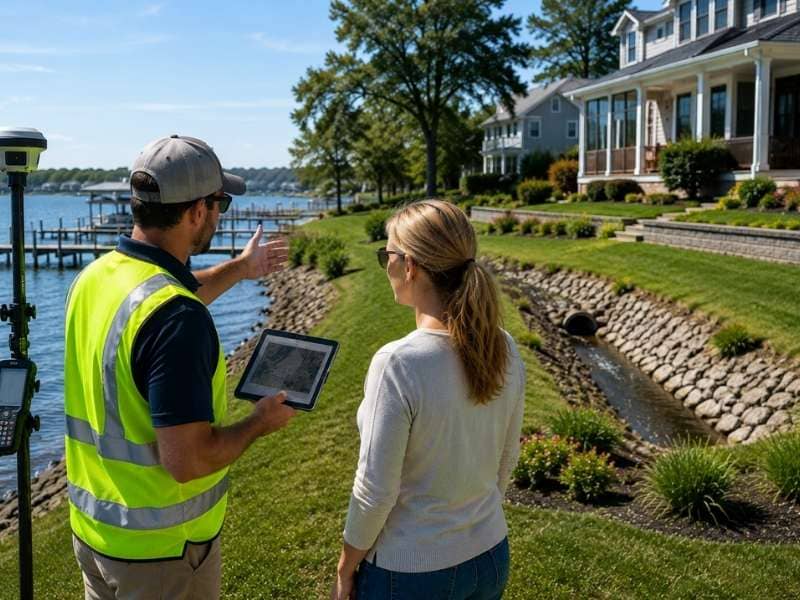
Elevation survey review with a surveyor and buyer discussing a waterfront property's drainage and elevation before closing.

Buying a home near water takes more research than buying inland. The land itself matters as much as the house. An elevation survey shows how the property sits on the ground, how high the home is compared to the area around it, and whether the land has changed over time. Buyers who ask the right questions before closing have a much clearer picture of what they’re getting.

Is the Home High Enough Above the Ground?

The height of a home above the surrounding land affects how water behaves during heavy rain or a storm surge. A house that sits low compared to the yard and street nearby faces a higher chance of water reaching the foundation or entering the structure. One that sits higher has more natural protection.

An elevation survey measures the height of the home and compares it to the land around it. Buyers should ask what that comparison shows. If the home sits in a low spot, water from nearby areas can move toward it during a flood event rather than away from it. Knowing this before closing gives buyers a realistic picture of the property’s vulnerability.

Have Storms or Erosion Changed the Property?

Land near bays, rivers, and coastal areas changes over time. Storms can shift soil, reshape shorelines, and erode ground that was once stable. Heavy rain can wash away fill material or change the grade of the land in ways that aren’t obvious from a simple walkthrough.

Buyers should ask whether the elevation survey reflects current conditions or was done several years ago. An older survey may show the property as it looked before a major storm or after years of gradual erosion that changed the terrain. A recent survey gives a more accurate picture of what the land actually looks like now and whether any changes have affected the stability or drainage of the lot.

Does Water Drain Away From the House?

The slope of the land around a home determines where water goes after it rains. Ideally, the ground slopes away from the foundation on all sides so water moves away from the house and doesn’t collect around it. When the land slopes toward the house or sits flat with no clear drainage path, water can pool near the foundation and cause long-term problems.

An elevation survey shows the grade of the land and how it directs water flow. Buyers should ask whether the survey data shows water draining away from the home or collecting near it. This question is especially important for homes close to the water where the ground is often flat and drainage can be slow. Understanding this before closing helps buyers know what they may be dealing with after a heavy rain.

Can the Property Support Future Outdoor Projects?

Many buyers near the water plan to add a pool, a patio, a garage, or an extended driveway at some point after moving in. Whether those projects are possible depends on the land itself. Low spots, steep grades, soft soil areas, and drainage issues can all limit where improvements can be placed and how they need to be built.

An elevation survey provides the land data that builders and contractors use when planning outdoor projects. Buyers who ask for that information before closing can find out early whether the lot can support their plans. A property that looks perfect from the outside may have grade or drainage challenges that make certain projects much more expensive or difficult to complete than expected.

Should You Ask for an Updated Elevation Survey?

Survey documents have an age. The older a survey is, the less accurately it may reflect what’s on the ground today. Land near water is especially likely to change over time. Fill material settles. Shorelines shift. Neighboring construction can change drainage patterns across several lots.

Buyers should ask when the most recent elevation survey was completed and whether a new one is available. If the existing survey is several years old, requesting an updated one before closing is a reasonable step. An updated survey reflects the current state of the property, not how it looked after the last transaction. That information gives buyers the most accurate foundation for their decision.

Frequently Asked Questions

What is an elevation survey?

An elevation survey measures the height of the land and structures on a property. It shows how high the home sits compared to the surrounding ground and helps identify how water moves across the lot.

Why should I review an elevation survey before closing?

It gives buyers a clear picture of the property’s terrain, drainage, and how the home relates to the land around it. That information helps buyers understand possible concerns before the purchase is final.

Can an elevation survey show drainage problems?

Yes. An elevation survey shows the slope of the land and whether water tends to drain away from the home or collect near it. That information is useful for understanding how the property handles rain.

Can an elevation survey help with future projects?

Yes. Builders and contractors use elevation data when planning pools, patios, driveways, and other outdoor improvements. Reviewing the survey before closing helps buyers understand what the land can support.

Can an older elevation survey become outdated?

Yes. Changes to the land from storms, erosion, nearby construction, or settling can make older survey information less accurate. An updated survey reflects the current condition of the property.

Posted in elevation certificate

Post navigation

← Older posts
Newer posts →

Contact Us Now

    Categories

    • alta survey
    • blog
    • Boundary survey
    • construction staking
    • elevation certificate
    • flooding
    • GPS
    • land surveying
    • land surveyor
    • LiDAR mapping
    • Topo Survey
    © Copyright Daphne Land Surveying
    Daphne, Alabama 36526
    Phone: (251) 270-4140

    Privacy Policy | Terms of Use

    Web Development and SEO by:
    AuburnBusiness.com

    The owner of this website, USA Surveying & Engineering, LLC., provides coordination of professional land surveying and engineering services in all 50 states. The professional surveying and engineering services provided to you will be conducted by fully licensed professionals in your state.

    Privacy Policy
    ↑